
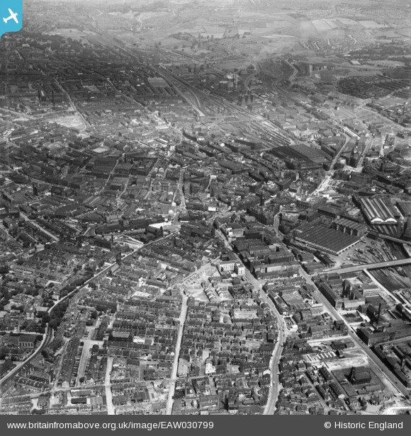
EAW030799 ENGLAND (1950). The city centre, Bradford, 1950
© Copyright OpenStreetMap contributors and licensed by the OpenStreetMap Foundation. 2026. Cartography is licensed as CC BY-SA.
Nearby Images (29)
EAW030799

EPW057186

EPW024501

EPW054319

EPW024390

EAW030798

EPW028913

EPW028912

EPW057183

EAW030801

EPW054313

EPW024404

EPW024521

EPW024395

EAW030800

EPW024392

EPW052165

EPW024393

EPW057191

EPW057189

EPW024409

EPW024505

EPW028915

EPW045334

EPW054312

EPW054316

EPW051228

EPW052163

EPW057184

Details
| Title | [EAW030799] The city centre, Bradford, 1950 |
| Reference | EAW030799 |
| Date | 28-June-1950 |
| Link | |
| Place name | BRADFORD |
| Parish | |
| District | |
| Country | ENGLAND |
| Easting / Northing | 416207, 432962 |
| Longitude / Latitude | -1.7539497944453, 53.792503023712 |
| National Grid Reference | SE162330 |
Pins

gBr |
Thursday 6th of April 2023 09:10:35 PM | |
|
gBr |
Thursday 6th of April 2023 09:06:26 PM | |
|
John N |
Saturday 24th of October 2020 12:32:54 AM | |
|
John N |
Saturday 24th of October 2020 12:31:43 AM | |
|
John N |
Saturday 24th of October 2020 12:31:00 AM | |
|
gBr |
Thursday 16th of March 2017 07:35:14 PM | |
|
gBr |
Thursday 16th of March 2017 07:29:45 PM | |
|
gBr |
Thursday 16th of March 2017 07:28:47 PM | |
|
trevorsboy |
Monday 7th of March 2016 11:53:42 AM | |
|
Booey |
Wednesday 22nd of October 2014 04:39:12 AM |
