
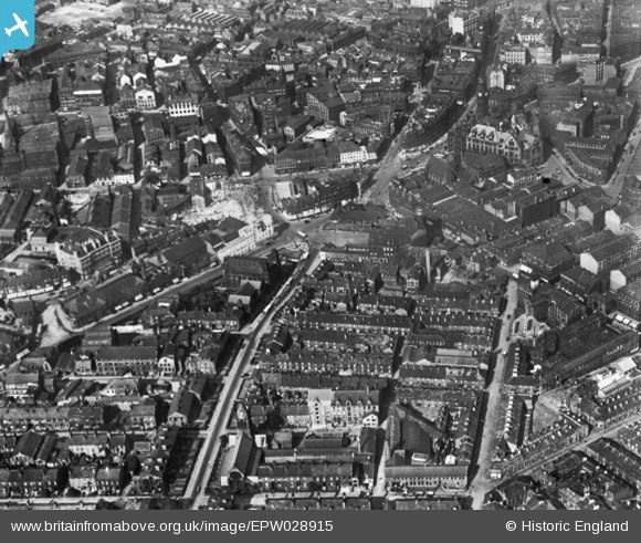
EPW028915 ENGLAND (1929). The city centre, Bradford, 1929. This image has been produced from a print.
© Copyright OpenStreetMap contributors and licensed by the OpenStreetMap Foundation. 2026. Cartography is licensed as CC BY-SA.
Nearby Images (24)
EPW028915

EPW051228

EPW024393

EPW024404

EPW028912

EPW024521

EAW030801

EPW028913

EPW024390

EPW024392

EPW057183

EPW054319

EAW030799

EPW057186

EPW024501

EAW030798

EPW054313

EPW024395

EAW030800

EPW057191

EPW057189

EPW024409

EPW024505

EPW054312

Details
| Title | [EPW028915] The city centre, Bradford, 1929. This image has been produced from a print. |
| Reference | EPW028915 |
| Date | 4-September-1929 |
| Link | |
| Place name | BRADFORD |
| Parish | |
| District | |
| Country | ENGLAND |
| Easting / Northing | 416161, 432794 |
| Longitude / Latitude | -1.7546569589385, 53.790994312551 |
| National Grid Reference | SE162328 |
Pins

Peter Lanky |
Sunday 13th of February 2022 01:39:18 PM | |
|
danimo77 |
Sunday 4th of January 2015 01:30:34 AM |