
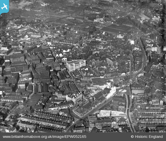
EPW052165 ENGLAND (1936). Thornton Road and the city centre, Bradford, 1936. This image has been produced from a print.
© Copyright OpenStreetMap contributors and licensed by the OpenStreetMap Foundation. 2026. Cartography is licensed as CC BY-SA.
Nearby Images (25)
EPW052165

EAW030798

EPW045334

EPW054319

EPW057186

EPW024501

EAW030799

EPW052163

EPW024390

EPW028913

EPW028912

EPW054313

EPW024404

EAW030801

EPW057183

EPW024395

EPW024393

EPW024521

EAW030800

EPW024392

EPW057191

EPW024505

EPW057189

EPW024409

EPW057190

Details
| Title | [EPW052165] Thornton Road and the city centre, Bradford, 1936. This image has been produced from a print. |
| Reference | EPW052165 |
| Date | October-1936 |
| Link | |
| Place name | BRADFORD |
| Parish | |
| District | |
| Country | ENGLAND |
| Easting / Northing | 416125, 433052 |
| Longitude / Latitude | -1.7551899726362, 53.793314575815 |
| National Grid Reference | SE161331 |
Pins

Shipley Flyer |
Sunday 4th of June 2023 11:16:57 PM | |
|
Tas |
Monday 2nd of August 2021 06:48:46 PM |