
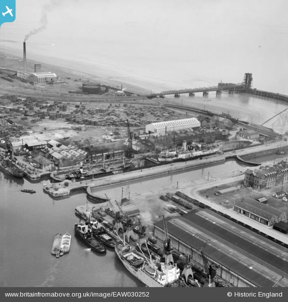
EAW030252 ENGLAND (1950). The Humber Graving Dock alongside Immingham Dock Lock, Immingham, 1950
© Copyright OpenStreetMap contributors and licensed by the OpenStreetMap Foundation. 2026. Cartography is licensed as CC BY-SA.
Nearby Images (21)
EAW030252

EAW029081

EAW030251

EAW029089

EAW030244

EAW029079

EAW030242

EAW030247

EAW030241

EAW030250

EAW029082

EAW030253

EAW029088

EAW029083

EAW029091

EPW006532

EAW029084

EAW030243

EAW030249

EAW029085

EAW030248

Details
| Title | [EAW030252] The Humber Graving Dock alongside Immingham Dock Lock, Immingham, 1950 |
| Reference | EAW030252 |
| Date | 13-June-1950 |
| Link | |
| Place name | IMMINGHAM |
| Parish | IMMINGHAM |
| District | |
| Country | ENGLAND |
| Easting / Northing | 519773, 416339 |
| Longitude / Latitude | -0.18856153167417, 53.629622789435 |
| National Grid Reference | TA198163 |
Pins
Be the first to add a comment to this image!