
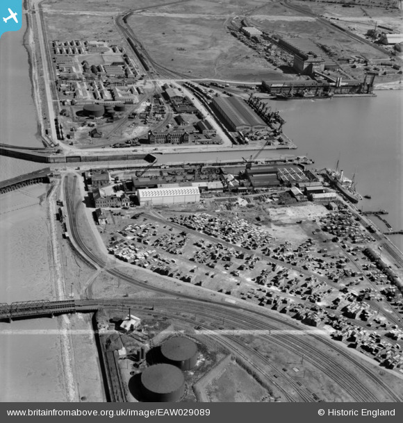
EAW029089 ENGLAND (1950). Immingham Dock, Immingham, 1950. image was marked by Aerofilms Ltd for photo editing.
© Copyright OpenStreetMap contributors and licensed by the OpenStreetMap Foundation. 2026. Cartography is licensed as CC BY-SA.
Nearby Images (21)
EAW029089

EAW030251

EAW030244

EAW029081

EAW030247

EAW030252

EAW030241

EAW030242

EAW029079

EAW029088

EAW030253

EAW030250

EAW029082

EAW029083

EAW029091

EAW029084

EAW030245

EAW030246

EPW006532

EAW030243

EAW029085

Details
| Title | [EAW029089] Immingham Dock, Immingham, 1950. image was marked by Aerofilms Ltd for photo editing. |
| Reference | EAW029089 |
| Date | 10-May-1950 |
| Link | |
| Place name | IMMINGHAM |
| Parish | IMMINGHAM |
| District | |
| Country | ENGLAND |
| Easting / Northing | 519717, 416367 |
| Longitude / Latitude | -0.18939723379179, 53.629887172956 |
| National Grid Reference | TA197164 |


