
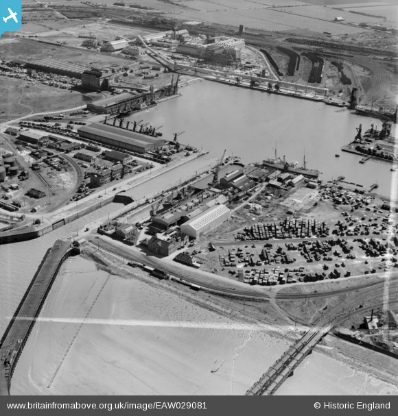
EAW029081 ENGLAND (1950). Immingham Dock, Immingham, 1950. This image was marked by Aerofilms Ltd for photo editing.
© Copyright OpenStreetMap contributors and licensed by the OpenStreetMap Foundation. 2026. Cartography is licensed as CC BY-SA.
Nearby Images (21)
EAW029081

EAW030252

EAW030251

EAW029089

EAW030244

EAW029079

EAW030247

EAW030242

EAW030250

EAW030241

EAW029082

EAW030253

EAW029083

EAW029088

EAW029091

EAW029084

EPW006532

EAW030243

EAW030249

EAW029085

EAW030248

Details
| Title | [EAW029081] Immingham Dock, Immingham, 1950. This image was marked by Aerofilms Ltd for photo editing. |
| Reference | EAW029081 |
| Date | 10-May-1950 |
| Link | |
| Place name | IMMINGHAM |
| Parish | IMMINGHAM |
| District | |
| Country | ENGLAND |
| Easting / Northing | 519774, 416348 |
| Longitude / Latitude | -0.18854295169207, 53.629703423566 |
| National Grid Reference | TA198163 |
Pins

MB |
Saturday 23rd of January 2021 05:29:26 PM | |
|
MB |
Saturday 23rd of January 2021 05:28:45 PM | |
|
MB |
Saturday 23rd of January 2021 05:27:53 PM | |
|
MB |
Saturday 23rd of January 2021 05:25:25 PM | |
|
MB |
Saturday 23rd of January 2021 05:24:44 PM | |
|
MB |
Saturday 23rd of January 2021 05:21:37 PM | |
|
MB |
Saturday 23rd of January 2021 05:19:21 PM | |
|
MB |
Saturday 23rd of January 2021 05:18:34 PM | |
|
MB |
Saturday 23rd of January 2021 05:16:59 PM | |
|
MB |
Saturday 23rd of January 2021 05:15:01 PM | |
|
MB |
Saturday 23rd of January 2021 05:12:17 PM | |
|
MB |
Saturday 23rd of January 2021 05:10:56 PM | |
|
MB |
Saturday 23rd of January 2021 05:09:29 PM | |
|
redmist |
Saturday 23rd of February 2019 10:44:37 PM |