
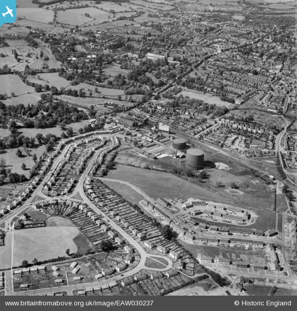
EAW030237 ENGLAND (1950). The gas works and city, St Albans, 1950
© Copyright OpenStreetMap contributors and licensed by the OpenStreetMap Foundation. 2026. Cartography is licensed as CC BY-SA.
Nearby Images (16)
EAW030237

EAW030947

EAW030956

EAW030957

EAW030950

EAW030958

EAW030949

EAW030232

EAW030236

EAW030946

EPW016807

EPW061045

EPW061046

EPW061042

EPW061043

EPW061044

Details
| Title | [EAW030237] The gas works and city, St Albans, 1950 |
| Reference | EAW030237 |
| Date | 12-June-1950 |
| Link | |
| Place name | ST ALBANS |
| Parish | |
| District | |
| Country | ENGLAND |
| Easting / Northing | 514622, 206120 |
| Longitude / Latitude | -0.33968386098443, 51.741590010392 |
| National Grid Reference | TL146061 |
Pins
Be the first to add a comment to this image!