
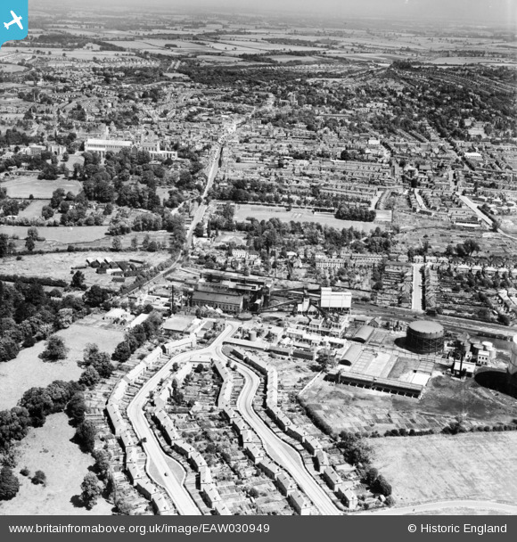
EAW030949 ENGLAND (1950). Doggett's Way, the Gas Works and the city, St Albans, from the south, 1950
© Copyright OpenStreetMap contributors and licensed by the OpenStreetMap Foundation. 2026. Cartography is licensed as CC BY-SA.
Nearby Images (15)
EAW030949

EAW030950

EPW061045

EPW061042

EPW061046

EPW061043

EAW030957

EPW061044

EAW030958

EAW030947

EAW030237

EPW016807

EAW030956

EAW030959

EAW030240

Details
| Title | [EAW030949] Doggett's Way, the Gas Works and the city, St Albans, from the south, 1950 |
| Reference | EAW030949 |
| Date | 13-July-1950 |
| Link | |
| Place name | ST ALBANS |
| Parish | |
| District | |
| Country | ENGLAND |
| Easting / Northing | 514500, 206196 |
| Longitude / Latitude | -0.34142523062268, 51.742298071716 |
| National Grid Reference | TL145062 |
Pins
Be the first to add a comment to this image!