
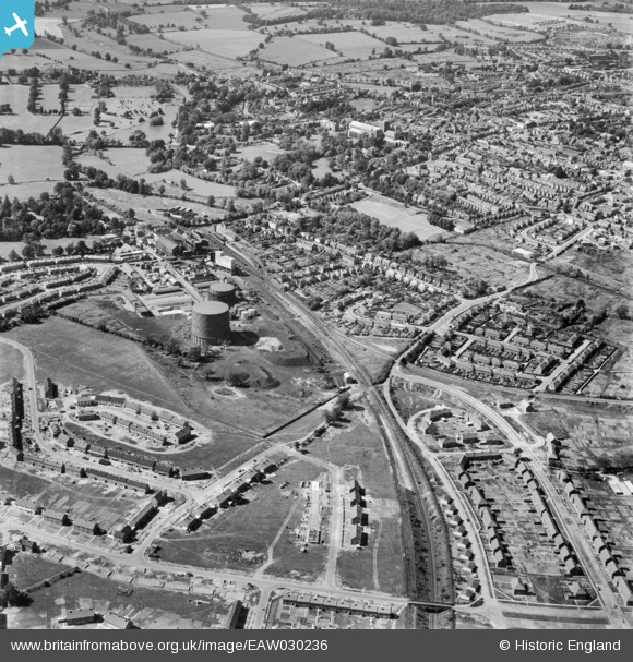
EAW030236 ENGLAND (1950). The gas works and city, St Albans, 1950
© Copyright OpenStreetMap contributors and licensed by the OpenStreetMap Foundation. 2026. Cartography is licensed as CC BY-SA.
Nearby Images (9)
EAW030236

EAW030232

EAW030956

EAW030957

EAW030958

EAW030237

EAW030951

EAW030947

EPW016807

Details
| Title | [EAW030236] The gas works and city, St Albans, 1950 |
| Reference | EAW030236 |
| Date | 12-June-1950 |
| Link | |
| Place name | ST ALBANS |
| Parish | |
| District | |
| Country | ENGLAND |
| Easting / Northing | 514774, 206226 |
| Longitude / Latitude | -0.33744813927565, 51.742511658229 |
| National Grid Reference | TL148062 |
Pins

ShadyWolf |
Thursday 1st of October 2020 10:12:39 PM | |
|
John W |
Tuesday 2nd of August 2016 05:48:24 PM | |
|
John W |
Tuesday 2nd of August 2016 05:45:23 PM | |
|
John W |
Tuesday 2nd of August 2016 05:44:22 PM | |
|
John W |
Tuesday 2nd of August 2016 05:43:08 PM | |
|
John W |
Friday 8th of July 2016 06:31:10 PM | |
|
John W |
Friday 8th of July 2016 06:30:21 PM | |
|
John W |
Friday 8th of July 2016 06:28:47 PM | |
|
John W |
Friday 8th of July 2016 06:27:34 PM |