
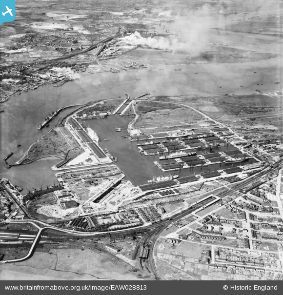
EAW028813 ENGLAND (1950). Tilbury Docks and the River Thames, Tilbury, 1950
© Copyright OpenStreetMap contributors and licensed by the OpenStreetMap Foundation. 2026. Cartography is licensed as CC BY-SA.
Nearby Images (22)
EAW028813

EAW028809

EPW032809

EPW006261

EPW044211

EAW028810

EPW044214

EPW044215

EPW001398

EAW028812

EPW044212

EPW018636

EPW032810

EAW002337

EAW028808

EPW017646

EPW044222

EPW032812

EPW032807

EPW032804

EPW044220

EPW018637

Details
| Title | [EAW028813] Tilbury Docks and the River Thames, Tilbury, 1950 |
| Reference | EAW028813 |
| Date | 1-May-1950 |
| Link | |
| Place name | TILBURY |
| Parish | |
| District | |
| Country | ENGLAND |
| Easting / Northing | 563398, 175649 |
| Longitude / Latitude | 0.35210040509071, 51.455717633096 |
| National Grid Reference | TQ634756 |
Pins

Kate N |
Monday 31st of March 2014 08:48:03 PM | |
|
Kate N |
Monday 31st of March 2014 08:39:31 PM | |
|
Kate N |
Monday 31st of March 2014 08:38:53 PM |