
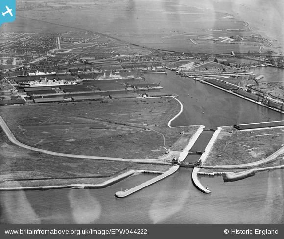
EPW044222 ENGLAND (1934). Tilbury Docks and environs, Tilbury, 1934
© Copyright OpenStreetMap contributors and licensed by the OpenStreetMap Foundation. 2026. Cartography is licensed as CC BY-SA.
Nearby Images (9)
EPW044222

EAW030540

EPW044212

EAW002337

EPW044214

EPW044213

EAW028809

EAW028813

EPW032809

Details
| Title | [EPW044222] Tilbury Docks and environs, Tilbury, 1934 |
| Reference | EPW044222 |
| Date | May-1934 |
| Link | |
| Place name | TILBURY |
| Parish | |
| District | |
| Country | ENGLAND |
| Easting / Northing | 563172, 175579 |
| Longitude / Latitude | 0.34881779811436, 51.455153872293 |
| National Grid Reference | TQ632756 |
Pins
Be the first to add a comment to this image!