
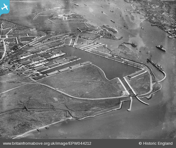
EPW044212 ENGLAND (1934). Tilbury Docks and environs, Tilbury, 1934
© Copyright OpenStreetMap contributors and licensed by the OpenStreetMap Foundation. 2026. Cartography is licensed as CC BY-SA.
Nearby Images (15)
EPW044212

EPW044214

EPW044222

EAW002337

EPW032809

EAW028813

EAW028809

EAW030540

EPW044213

EAW028810

EPW044215

EPW006261

EPW044221

EAW028812

EAW028808

Details
| Title | [EPW044212] Tilbury Docks and environs, Tilbury, 1934 |
| Reference | EPW044212 |
| Date | May-1934 |
| Link | |
| Place name | TILBURY |
| Parish | |
| District | |
| Country | ENGLAND |
| Easting / Northing | 563234, 175660 |
| Longitude / Latitude | 0.34974685152663, 51.455863783197 |
| National Grid Reference | TQ632757 |
Pins
Be the first to add a comment to this image!