
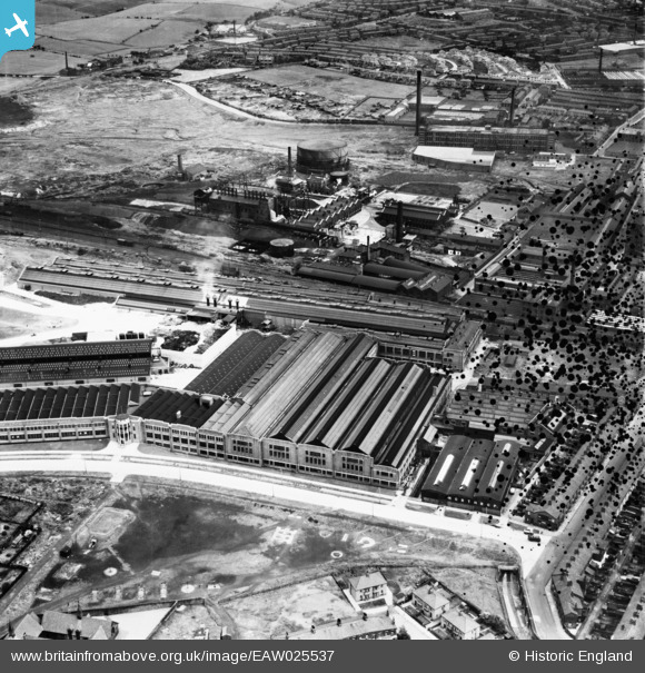
EAW025537 ENGLAND (1949). The Northrop Loom Works, Blackburn, 1949. This image has been produced from a damaged negative.
© Copyright OpenStreetMap contributors and licensed by the OpenStreetMap Foundation. 2026. Cartography is licensed as CC BY-SA.
Nearby Images (19)
EAW025537

EAW025538

EAW025527

EAW025532

EAW025534

EAW025539

EAW025536

EAW025526

EAW025533

EAW025535

EAW025540

EPW038980

EAW025530

EAW025531

EAW025529

EPW038982

EPW038983

EPW038981

EAW025528

Details
| Title | [EAW025537] The Northrop Loom Works, Blackburn, 1949. This image has been produced from a damaged negative. |
| Reference | EAW025537 |
| Date | 3-August-1949 |
| Link | |
| Place name | BLACKBURN |
| Parish | |
| District | |
| Country | ENGLAND |
| Easting / Northing | 369737, 429018 |
| Longitude / Latitude | -2.4590517364226, 53.756423703367 |
| National Grid Reference | SD697290 |
Pins

Matt Aldred edob.mattaldred.com |
Tuesday 7th of January 2025 11:29:55 AM | |
|
Matt Aldred edob.mattaldred.com |
Friday 8th of March 2024 06:22:49 PM | |

redmist |
Friday 22nd of March 2019 09:22:50 AM |