
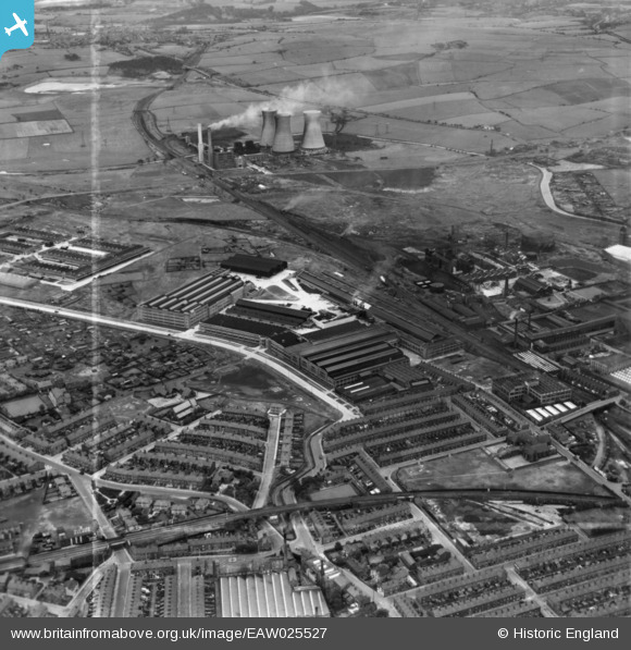
EAW025527 ENGLAND (1949). The Northrop Loom Works and environs, Blackburn, 1949. This image has been produced from a print marked by Aerofilms Ltd for photo editing.
© Copyright OpenStreetMap contributors and licensed by the OpenStreetMap Foundation. 2026. Cartography is licensed as CC BY-SA.
Nearby Images (16)
EAW025527

EAW025538

EAW025539

EAW025537

EAW025534

EAW025536

EAW025535

EAW025533

EAW025532

EAW025526

EAW025540

EPW038980

EPW038982

EAW025528

EPW038983

EPW038981

Details
| Title | [EAW025527] The Northrop Loom Works and environs, Blackburn, 1949. This image has been produced from a print marked by Aerofilms Ltd for photo editing. |
| Reference | EAW025527 |
| Date | 3-August-1949 |
| Link | |
| Place name | BLACKBURN |
| Parish | |
| District | |
| Country | ENGLAND |
| Easting / Northing | 369733, 429090 |
| Longitude / Latitude | -2.4591194674149, 53.757070663622 |
| National Grid Reference | SD697291 |
Pins
Be the first to add a comment to this image!