
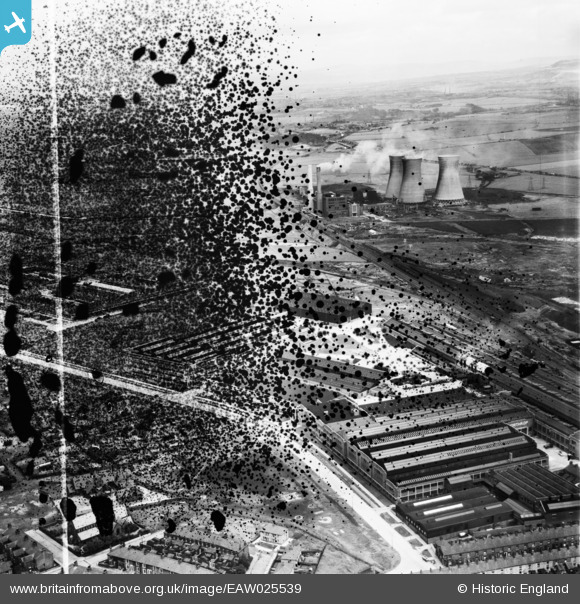
EAW025539 ENGLAND (1949). The Northrop Loom Works, Blackburn, from the west, 1949. This image has been produced from a damaged negative.
© Copyright OpenStreetMap contributors and licensed by the OpenStreetMap Foundation. 2026. Cartography is licensed as CC BY-SA.
Nearby Images (12)
EAW025539

EAW025534

EAW025527

EAW025538

EAW025533

EAW025526

EAW025535

EAW025536

EAW025537

EAW025540

EAW025532

EPW038980

Details
| Title | [EAW025539] The Northrop Loom Works, Blackburn, from the west, 1949. This image has been produced from a damaged negative. |
| Reference | EAW025539 |
| Date | 3-August-1949 |
| Link | |
| Place name | BLACKBURN |
| Parish | |
| District | |
| Country | ENGLAND |
| Easting / Northing | 369685, 429133 |
| Longitude / Latitude | -2.4598517746833, 53.75745439066 |
| National Grid Reference | SD697291 |
Pins
Be the first to add a comment to this image!