
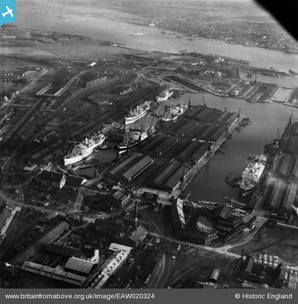
EAW020324 ENGLAND (1948). Tilbury Docks, Tilbury, 1948. This image has been produced from a print.
© Copyright OpenStreetMap contributors and licensed by the OpenStreetMap Foundation. 2026. Cartography is licensed as CC BY-SA.
Nearby Images (26)
EAW020324

EPW001397

EPW032803

EPR000361

EAW002338

EPW001400

EPW032807A

EPW044221

EPW001399

EAW028808

EPW032808

EPW032802

EPW032804

EPW032811

EPW032812

EPW032807

EPW032808A

EAW020323

EPW006264

EPW001396

EAW028812

EPW018637

EPW001398

EPW044220

EPW017646

EPW032810

Details
| Title | [EAW020324] Tilbury Docks, Tilbury, 1948. This image has been produced from a print. |
| Reference | EAW020324 |
| Date | 4-November-1948 |
| Link | |
| Place name | TILBURY |
| Parish | |
| District | |
| Country | ENGLAND |
| Easting / Northing | 563422, 175974 |
| Longitude / Latitude | 0.35259576459752, 51.458630825471 |
| National Grid Reference | TQ634760 |
Pins
Be the first to add a comment to this image!