
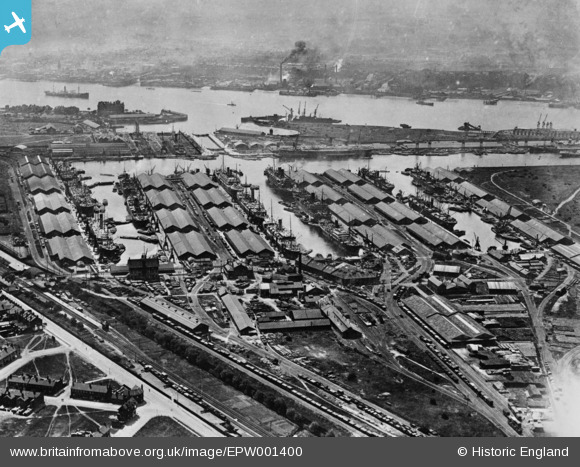
EPW001400 ENGLAND (1920). Tilbury Docks, Tilbury, 1920. This image has been produced from a copy-negative.
© Copyright OpenStreetMap contributors and licensed by the OpenStreetMap Foundation. 2026. Cartography is licensed as CC BY-SA.
Nearby Images (23)
EPW001400

EPW032803

EPW001399

EPW032807A

EPW001397

EPW032808A

EAW020324

EPR000361

EAW002338

EPW032802

EPW032808

EPW006264

EPW032804

EPW032811

EAW020323

EPW032807

EPW032812

EAW028808

EPW001396

EPW044221

EPW018637

EAW020325

EPW044220

Details
| Title | [EPW001400] Tilbury Docks, Tilbury, 1920. This image has been produced from a copy-negative. |
| Reference | EPW001400 |
| Date | 7-June-1920 |
| Link | |
| Place name | TILBURY |
| Parish | |
| District | |
| Country | ENGLAND |
| Easting / Northing | 563473, 176044 |
| Longitude / Latitude | 0.3533616493478, 51.459245046767 |
| National Grid Reference | TQ635760 |
Pins
Be the first to add a comment to this image!