
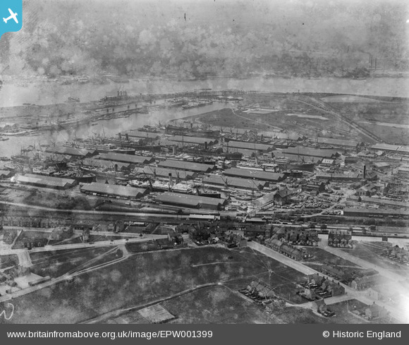
EPW001399 ENGLAND (1920). Tilbury Docks, Tilbury, 1920
© Copyright OpenStreetMap contributors and licensed by the OpenStreetMap Foundation. 2026. Cartography is licensed as CC BY-SA.
Nearby Images (24)
EPW001399

EPW032808A

EPW001400

EPW032803

EPW032802

EPW001397

EPW032808

EAW020324

EPW032807A

EPW032811

EPW032804

EPR000361

EPW001396

EPW032807

EAW002338

EPW032812

EPW018637

EAW020325

EAW028808

EPW006264

EPW044220

EPW044221

EAW020323

EAW028812

Details
| Title | [EPW001399] Tilbury Docks, Tilbury, 1920 |
| Reference | EPW001399 |
| Date | 7-June-1920 |
| Link | |
| Place name | TILBURY |
| Parish | |
| District | |
| Country | ENGLAND |
| Easting / Northing | 563520, 176026 |
| Longitude / Latitude | 0.35402932432962, 51.459069740781 |
| National Grid Reference | TQ635760 |
