
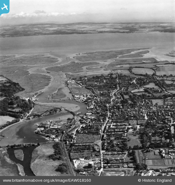
EAW018160 ENGLAND (1948). Lymington River and the town, Lymington, from the north-west, 1948. This image has been produced from a print.
© Copyright OpenStreetMap contributors and licensed by the OpenStreetMap Foundation. 2026. Cartography is licensed as CC BY-SA.
Nearby Images (10)
EAW018160

EPW037448

EPW022937

EPW022939

EPW022938

EPW013642

EPW013646

EAW043398

EAW018162

EPW022941

Details
| Title | [EAW018160] Lymington River and the town, Lymington, from the north-west, 1948. This image has been produced from a print. |
| Reference | EAW018160 |
| Date | 16-August-1948 |
| Link | |
| Place name | LYMINGTON |
| Parish | LYMINGTON AND PENNINGTON |
| District | |
| Country | ENGLAND |
| Easting / Northing | 432684, 95752 |
| Longitude / Latitude | -1.5365566387958, 50.759870769266 |
| National Grid Reference | SZ327958 |
Pins
Be the first to add a comment to this image!