
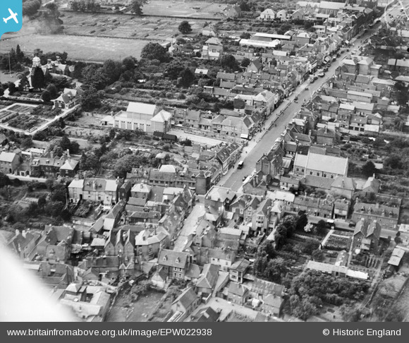
EPW022938 ENGLAND (1928). The Masonic Hall and High Street, Lymington, 1928
© Copyright OpenStreetMap contributors and licensed by the OpenStreetMap Foundation. 2026. Cartography is licensed as CC BY-SA.
Nearby Images (10)
EPW022938

EPW022939

EPW037448

EAW018160

EAW018162

EPW013646

EPW022937

EPW022941

EPW013642

EPW022930

Details
| Title | [EPW022938] The Masonic Hall and High Street, Lymington, 1928 |
| Reference | EPW022938 |
| Date | August-1928 |
| Link | |
| Place name | LYMINGTON |
| Parish | LYMINGTON AND PENNINGTON |
| District | |
| Country | ENGLAND |
| Easting / Northing | 432655, 95581 |
| Longitude / Latitude | -1.536983006004, 50.758334538788 |
| National Grid Reference | SZ327956 |
Pins
Be the first to add a comment to this image!