
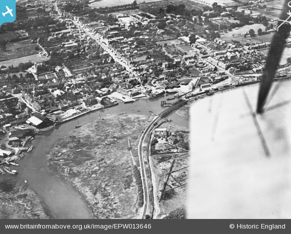
EPW013646 ENGLAND (1925). The town, Lymington, 1925. This image has been produced from a copy-negative.
© Copyright OpenStreetMap contributors and licensed by the OpenStreetMap Foundation. 2026. Cartography is licensed as CC BY-SA.
Nearby Images (19)
EPW013646

EPW022937

EPW013642

EPW037448

EPW022930

EPW022938

EPW022939

EAW025812

EAW018160

EAW025816

EAW025810

EAW025811

EAW025809

EAW025815

EPW022933

EAW025818

EAW025813

EAW025817

EAW025819

Details
| Title | [EPW013646] The town, Lymington, 1925. This image has been produced from a copy-negative. |
| Reference | EPW013646 |
| Date | June-1925 |
| Link | |
| Place name | LYMINGTON |
| Parish | LYMINGTON AND PENNINGTON |
| District | |
| Country | ENGLAND |
| Easting / Northing | 432828, 95631 |
| Longitude / Latitude | -1.5345256552464, 50.758774442735 |
| National Grid Reference | SZ328956 |
Pins
Be the first to add a comment to this image!