
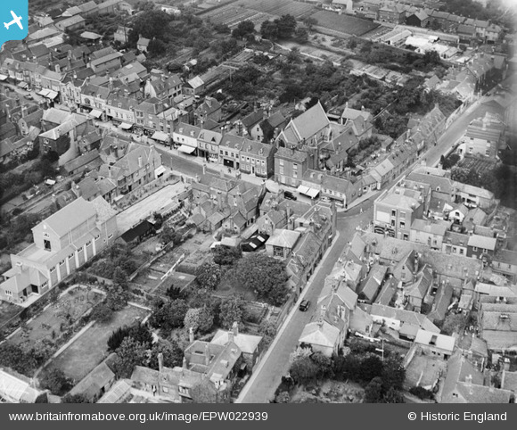
EPW022939 ENGLAND (1928). The Masonic Hall and environs, Lymington, 1928
© Copyright OpenStreetMap contributors and licensed by the OpenStreetMap Foundation. 2026. Cartography is licensed as CC BY-SA.
Nearby Images (10)
EPW022939

EPW022938

EPW037448

EAW018160

EAW018162

EPW013646

EPW022937

EPW022941

EPW013642

EPW022930

Details
| Title | [EPW022939] The Masonic Hall and environs, Lymington, 1928 |
| Reference | EPW022939 |
| Date | August-1928 |
| Link | |
| Place name | LYMINGTON |
| Parish | LYMINGTON AND PENNINGTON |
| District | |
| Country | ENGLAND |
| Easting / Northing | 432649, 95587 |
| Longitude / Latitude | -1.537067545007, 50.758388836622 |
| National Grid Reference | SZ326956 |
Pins

Class31 |
Saturday 1st of December 2012 08:24:37 AM | |
|
Class31 |
Saturday 1st of December 2012 08:24:17 AM | |
|
Class31 |
Saturday 1st of December 2012 08:23:39 AM | |
|
Class31 |
Saturday 1st of December 2012 08:23:21 AM | |
|
Class31 |
Saturday 1st of December 2012 08:23:03 AM |