
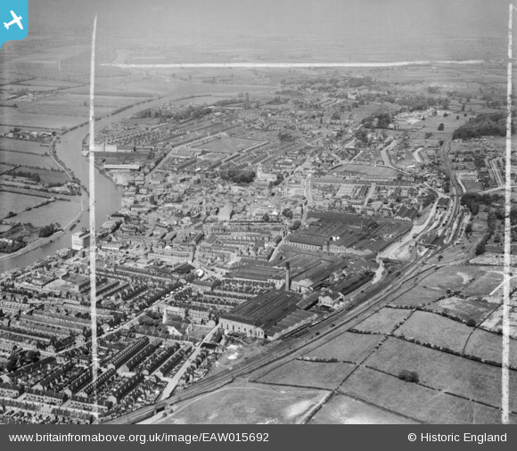
EAW015692 ENGLAND (1948). The Britannia Engineering Works and the town, Gainsborough, from the south-east, 1948. This image was marked by Aerofilms Ltd for photo editing.
© Copyright OpenStreetMap contributors and licensed by the OpenStreetMap Foundation. 2026. Cartography is licensed as CC BY-SA.
Nearby Images (18)
EAW015692

EPW062186

EPW062185

EPW016158

EPW062191

EAW015694

EPW062187

EPW062190

EAW015691

EAW015695

EAW015693

EAW015687

EAW015688

EAW015690

EPW016157

EAW015689

EPW062206

EAW025210

Details
| Title | [EAW015692] The Britannia Engineering Works and the town, Gainsborough, from the south-east, 1948. This image was marked by Aerofilms Ltd for photo editing. |
| Reference | EAW015692 |
| Date | 13-May-1948 |
| Link | |
| Place name | GAINSBOROUGH |
| Parish | GAINSBOROUGH |
| District | |
| Country | ENGLAND |
| Easting / Northing | 481788, 389553 |
| Longitude / Latitude | -0.7698561501503, 53.396201647927 |
| National Grid Reference | SK818896 |
Pins
Be the first to add a comment to this image!