
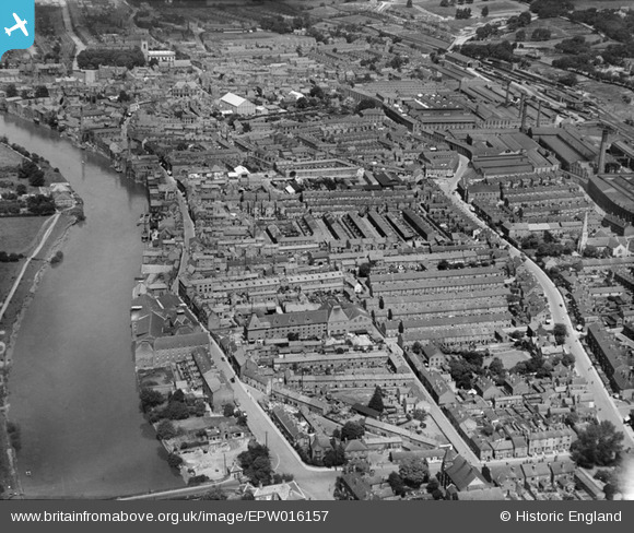
EPW016157 ENGLAND (1926). The town centre, Gainsborough, 1926
© Copyright OpenStreetMap contributors and licensed by the OpenStreetMap Foundation. 2026. Cartography is licensed as CC BY-SA.
Nearby Images (11)
EPW016157

EAW025210

EPW062207

EPW016162

EAW025212

EPW062210

EPW016163

EPW016158

EAW015692

EPW062186

EPW062185

Details
| Title | [EPW016157] The town centre, Gainsborough, 1926 |
| Reference | EPW016157 |
| Date | 2-July-1926 |
| Link | |
| Place name | GAINSBOROUGH |
| Parish | GAINSBOROUGH |
| District | |
| Country | ENGLAND |
| Easting / Northing | 481572, 389393 |
| Longitude / Latitude | -0.77314547273112, 53.394797059668 |
| National Grid Reference | SK816894 |
Pins

MB |
Friday 24th of January 2014 11:06:14 AM | |
|
MB |
Friday 24th of January 2014 11:05:43 AM | |
|
MB |
Friday 24th of January 2014 11:04:40 AM | |
|
MB |
Friday 24th of January 2014 11:04:16 AM | |
|
MB |
Friday 24th of January 2014 11:03:56 AM | |
|
kelpie |
Monday 4th of November 2013 12:23:03 PM | |
|
kelpie |
Monday 4th of November 2013 12:22:26 PM | |
|
Paddy Buckley |
Sunday 21st of October 2012 11:12:46 AM | |
|
Paddy Buckley |
Sunday 21st of October 2012 11:02:14 AM | |
|
Paddy Buckley |
Sunday 21st of October 2012 11:01:28 AM | |
|
Paddy Buckley |
Sunday 21st of October 2012 11:01:03 AM | |
|
Paddy Buckley |
Sunday 21st of October 2012 10:59:39 AM | |
|
Paddy Buckley |
Sunday 21st of October 2012 10:58:52 AM |