
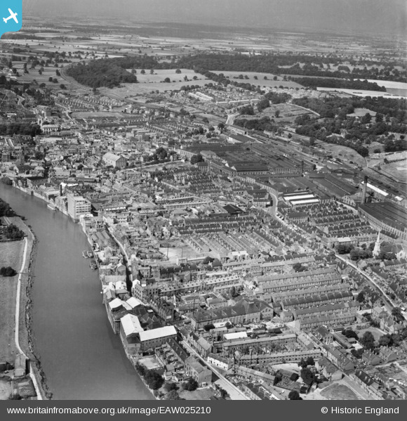
EAW025210 ENGLAND (1949). The town, Gainsborough, from the south, 1949
© Copyright OpenStreetMap contributors and licensed by the OpenStreetMap Foundation. 2026. Cartography is licensed as CC BY-SA.
Nearby Images (7)
EAW025210

EPW016157

EPW062207

EPW016163

EPW016162

EAW025212

EAW015692

Details
| Title | [EAW025210] The town, Gainsborough, from the south, 1949 |
| Reference | EAW025210 |
| Date | 26-July-1949 |
| Link | |
| Place name | GAINSBOROUGH |
| Parish | GAINSBOROUGH |
| District | |
| Country | ENGLAND |
| Easting / Northing | 481549, 389323 |
| Longitude / Latitude | -0.77350939891232, 53.394171483815 |
| National Grid Reference | SK815893 |
Pins
Be the first to add a comment to this image!