
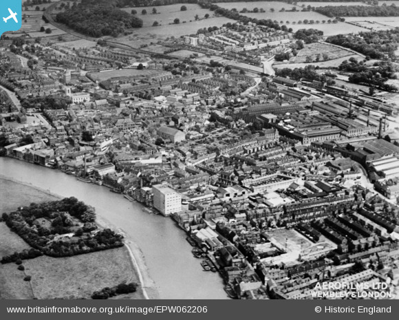
EPW062206 ENGLAND (1939). The town centre, Gainsborough, 1939. This image has been produced from a copy-negative.
© Copyright OpenStreetMap contributors and licensed by the OpenStreetMap Foundation. 2026. Cartography is licensed as CC BY-SA.
Nearby Images (14)
EPW062206

EPW016160

EAW015690

EPW062210

EPW016158

EAW015693

EAW015688

EAW015695

EPW016162

EPW062186

EPW062187

EPW062185

EPW016159

EAW015692

Details
| Title | [EPW062206] The town centre, Gainsborough, 1939. This image has been produced from a copy-negative. |
| Reference | EPW062206 |
| Date | 4-July-1939 |
| Link | |
| Place name | GAINSBOROUGH |
| Parish | GAINSBOROUGH |
| District | |
| Country | ENGLAND |
| Easting / Northing | 481553, 389750 |
| Longitude / Latitude | -0.77333889030727, 53.398008552635 |
| National Grid Reference | SK816898 |
Pins
Be the first to add a comment to this image!