
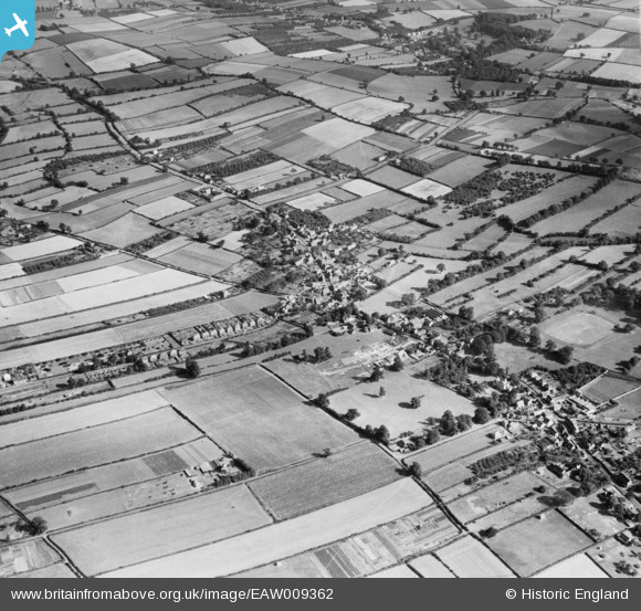
EAW009362 ENGLAND (1947). The village, Calverton, 1947
© Copyright OpenStreetMap contributors and licensed by the OpenStreetMap Foundation. 2026. Cartography is licensed as CC BY-SA.
Nearby Images (6)
EAW009362

EAW009368

EAW009369

EAW009367

EAW009363

EAW009366

Details
| Title | [EAW009362] The village, Calverton, 1947 |
| Reference | EAW009362 |
| Date | 17-August-1947 |
| Link | |
| Place name | CALVERTON |
| Parish | CALVERTON |
| District | |
| Country | ENGLAND |
| Easting / Northing | 461609, 349256 |
| Longitude / Latitude | -1.0810958178455, 53.036724002203 |
| National Grid Reference | SK616493 |
Pins

JasAloysius |
Tuesday 13th of May 2014 02:50:49 AM | |
|
JasAloysius |
Tuesday 13th of May 2014 02:49:40 AM | |
|
JasAloysius |
Tuesday 13th of May 2014 02:48:32 AM |
User Comment Contributions
Main Street, the parish church, Bonner Hill, Mansfield Lane (with the roof of the old Barton's bus garage) all so clearly visible. Mansfield Lane's semi-detached houses seem so isolated from the rest of the village! |
JasAloysius |
Thursday 8th of May 2014 10:03:33 PM |