
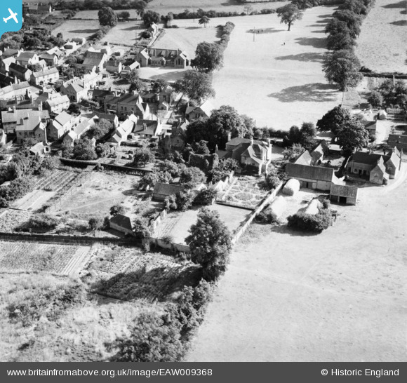
EAW009368 ENGLAND (1947). Properties on Main Street, Calverton, 1947
© Copyright OpenStreetMap contributors and licensed by the OpenStreetMap Foundation. 2026. Cartography is licensed as CC BY-SA.
Nearby Images (4)
EAW009368

EAW009369

EAW009367

EAW009362

Details
| Title | [EAW009368] Properties on Main Street, Calverton, 1947 |
| Reference | EAW009368 |
| Date | 17-August-1947 |
| Link | |
| Place name | CALVERTON |
| Parish | CALVERTON |
| District | |
| Country | ENGLAND |
| Easting / Northing | 461497, 349320 |
| Longitude / Latitude | -1.0827538647897, 53.037312189484 |
| National Grid Reference | SK615493 |
Pins

JasAloysius |
Monday 2nd of January 2017 10:39:40 PM | |
|
JasAloysius |
Tuesday 13th of May 2014 02:53:39 AM | |
|
JasAloysius |
Tuesday 13th of May 2014 02:52:24 AM |
User Comment Contributions
Taken during mid/late afternoon (notice the shadows) looking South from a position approx. over what is now the school campus area. The large building top centre is the St Wilfrid C of E school. Notice also the old Calverton Co-op and butchery shops (now demolished) to the front (North) of the school. Pedestrians crossing Main Street near The Nook! I wonder who they were......? |
JasAloysius |
Thursday 8th of May 2014 09:47:39 PM |