
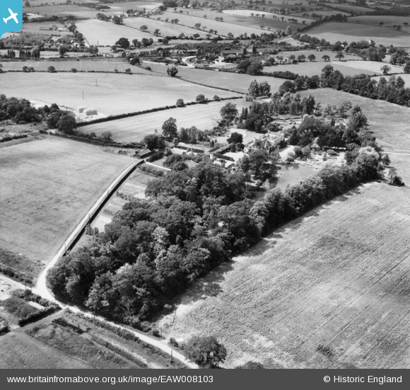
EAW008103 ENGLAND (1947). Thorpe Hall and environs, Thorpe-le-Soken, 1947
© Copyright OpenStreetMap contributors and licensed by the OpenStreetMap Foundation. 2026. Cartography is licensed as CC BY-SA.
Nearby Images (10)
EAW008103

EAW008104

EAW008096

EAW008097

EAW008100

EAW008101

EAW008099

EAW008102

EAW008098

EAW008105

Details
| Title | [EAW008103] Thorpe Hall and environs, Thorpe-le-Soken, 1947 |
| Reference | EAW008103 |
| Date | 12-July-1947 |
| Link | |
| Place name | THORPE-LE-SOKEN |
| Parish | THORPE-LE-SOKEN |
| District | |
| Country | ENGLAND |
| Easting / Northing | 618376, 221808 |
| Longitude / Latitude | 1.1711962196032, 51.851630561271 |
| National Grid Reference | TM184218 |
Pins

totoro |
Tuesday 27th of December 2016 12:49:33 PM | |
 |
totoro |
Tuesday 27th of December 2016 12:47:06 PM |
|
totoro |
Tuesday 27th of December 2016 12:46:03 PM | |
|
totoro |
Tuesday 27th of December 2016 12:44:27 PM | |
|
totoro |
Tuesday 27th of December 2016 12:40:54 PM | |
|
totoro |
Tuesday 27th of December 2016 12:20:16 PM | |
|
totoro |
Tuesday 27th of December 2016 12:13:55 PM | |
|
totoro |
Tuesday 27th of December 2016 12:13:30 PM | |
|
totoro |
Tuesday 27th of December 2016 12:13:09 PM |