
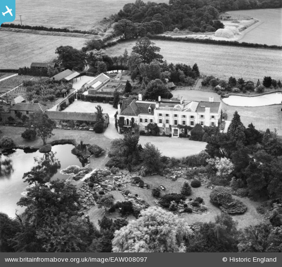
EAW008097 ENGLAND (1947). Thorpe Hall and gardens, Thorpe-le-Soken, 1947
© Copyright OpenStreetMap contributors and licensed by the OpenStreetMap Foundation. 2026. Cartography is licensed as CC BY-SA.
Nearby Images (10)
EAW008097

EAW008096

EAW008100

EAW008101

EAW008099

EAW008102

EAW008098

EAW008105

EAW008103

EAW008104

Details
| Title | [EAW008097] Thorpe Hall and gardens, Thorpe-le-Soken, 1947 |
| Reference | EAW008097 |
| Date | 12-July-1947 |
| Link | |
| Place name | THORPE-LE-SOKEN |
| Parish | THORPE-LE-SOKEN |
| District | |
| Country | ENGLAND |
| Easting / Northing | 618239, 221765 |
| Longitude / Latitude | 1.1691828844678, 51.851298074548 |
| National Grid Reference | TM182218 |
Pins

totoro |
Tuesday 27th of December 2016 11:22:53 AM | |
|
totoro |
Tuesday 27th of December 2016 11:22:30 AM | |
|
totoro |
Tuesday 27th of December 2016 11:21:24 AM | |
|
totoro |
Tuesday 27th of December 2016 11:21:01 AM |