
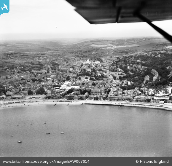
EAW007614 ENGLAND (1947). The town and seafront, Dover, from the south-east, 1947
© Copyright OpenStreetMap contributors and licensed by the OpenStreetMap Foundation. 2026. Cartography is licensed as CC BY-SA.
Nearby Images (13)
EAW007614

EPW000371

EAW007613

EAW007617

EAW007618

EPW039375

EAW022988

EPW019057

EAW007608

EAW007609

EPW039372

EPW038153

EPW038152

Details
| Title | [EAW007614] The town and seafront, Dover, from the south-east, 1947 |
| Reference | EAW007614 |
| Date | 28-June-1947 |
| Link | |
| Place name | DOVER |
| Parish | DOVER |
| District | |
| Country | ENGLAND |
| Easting / Northing | 632419, 141182 |
| Longitude / Latitude | 1.3216873961037, 51.122168084653 |
| National Grid Reference | TR324412 |
Pins

Alan McFaden |
Wednesday 9th of July 2014 05:56:51 PM | |
|
Alan McFaden |
Wednesday 9th of July 2014 05:56:21 PM | |
|
Alan McFaden |
Wednesday 9th of July 2014 05:55:47 PM | |
|
Alan McFaden |
Wednesday 9th of July 2014 05:55:08 PM | |
|
Alan McFaden |
Wednesday 9th of July 2014 05:54:35 PM |


