
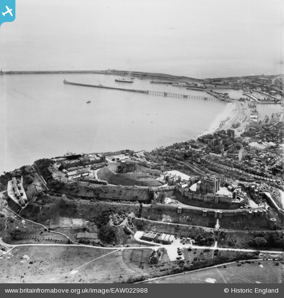
EAW022988 ENGLAND (1949). Dover Castle and the harbours, Dover, 1949
© Copyright OpenStreetMap contributors and licensed by the OpenStreetMap Foundation. 2026. Cartography is licensed as CC BY-SA.
Nearby Images (7)
EAW022988

EAW007608

EPW000347

EAW007614

EPW000371

EAW006160

EPW000349

Details
| Title | [EAW022988] Dover Castle and the harbours, Dover, 1949 |
| Reference | EAW022988 |
| Date | 6-May-1949 |
| Link | |
| Place name | DOVER |
| Parish | DOVER |
| District | |
| Country | ENGLAND |
| Easting / Northing | 632567, 141363 |
| Longitude / Latitude | 1.323915521381, 51.123733036855 |
| National Grid Reference | TR326414 |
Pins

Matt Aldred edob.mattaldred.com |
Tuesday 9th of March 2021 02:18:46 PM | |
|
Matt Aldred edob.mattaldred.com |
Tuesday 9th of March 2021 02:16:31 PM | |
|
Matt Aldred edob.mattaldred.com |
Tuesday 9th of March 2021 02:15:22 PM | |

mannidaze |
Sunday 14th of September 2014 07:10:11 PM | |
|
cptpies |
Thursday 9th of January 2014 09:00:14 AM | |
|
jrussill |
Wednesday 8th of January 2014 06:44:58 PM |
User Comment Contributions

WW2 Pillbox |
jrussill |
Wednesday 8th of January 2014 06:45:18 PM |