
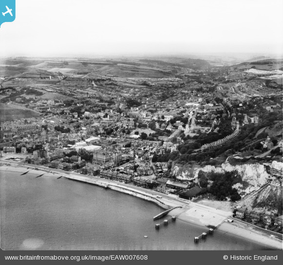
EAW007608 ENGLAND (1947). The town, Dover, from the east, 1947
© Copyright OpenStreetMap contributors and licensed by the OpenStreetMap Foundation. 2026. Cartography is licensed as CC BY-SA.
Nearby Images (14)
EAW007608

EAW022988

EAW007617

EPW000347

EAW006160

EPW038153

EAW007609

EPW000371

EPW039372

EAW007614

EPW038152

EPW039375

EPW000349

EAW007618

Details
| Title | [EAW007608] The town, Dover, from the east, 1947 |
| Reference | EAW007608 |
| Date | 28-June-1947 |
| Link | |
| Place name | DOVER |
| Parish | DOVER |
| District | |
| Country | ENGLAND |
| Easting / Northing | 632454, 141421 |
| Longitude / Latitude | 1.3223407969813, 51.124299617517 |
| National Grid Reference | TR325414 |
Pins

Matt Aldred edob.mattaldred.com |
Saturday 12th of July 2025 11:28:52 PM | |

Graham Yaxley |
Saturday 13th of December 2014 09:26:16 PM | |

Alan McFaden |
Wednesday 9th of July 2014 05:31:40 PM | |
|
Alan McFaden |
Wednesday 9th of July 2014 05:29:57 PM | |
|
Alan McFaden |
Wednesday 9th of July 2014 05:28:51 PM | |
|
Alan McFaden |
Wednesday 9th of July 2014 05:27:56 PM |


