
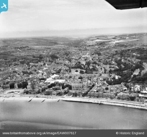
EAW007617 ENGLAND (1947). The town and seafront, Dover, from the east, 1947
© Copyright OpenStreetMap contributors and licensed by the OpenStreetMap Foundation. 2026. Cartography is licensed as CC BY-SA.
Nearby Images (17)
EAW007617

EAW007609

EPW039372

EPW038153

EPW000371

EPW038152

EPW039375

EAW007608

EAW007611

EAW007618

EAW007614

EPW019057

EAW007612

EPW039376

EPW035420

EPW039371

EAW006160

Details
| Title | [EAW007617] The town and seafront, Dover, from the east, 1947 |
| Reference | EAW007617 |
| Date | 28-June-1947 |
| Link | |
| Place name | DOVER |
| Parish | DOVER |
| District | |
| Country | ENGLAND |
| Easting / Northing | 632317, 141348 |
| Longitude / Latitude | 1.3203392132297, 51.123699796016 |
| National Grid Reference | TR323413 |
Pins

Alan McFaden |
Wednesday 9th of July 2014 06:03:32 PM | |
|
Alan McFaden |
Wednesday 9th of July 2014 06:02:50 PM | |
|
Alan McFaden |
Wednesday 9th of July 2014 06:02:14 PM | |
|
Alan McFaden |
Wednesday 9th of July 2014 06:01:39 PM | |
|
Alan McFaden |
Wednesday 9th of July 2014 06:00:57 PM |


