
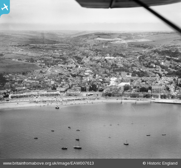
EAW007613 ENGLAND (1947). The town and seafront, Dover, from the south-east, 1947
© Copyright OpenStreetMap contributors and licensed by the OpenStreetMap Foundation. 2026. Cartography is licensed as CC BY-SA.
Nearby Images (14)
EAW007613

EAW007618

EPW039376

EPW019057

EPW035420

EPW039374

EAW007614

EPW000371

EPW039375

EAW007606

EAW007610

EPW000579

EAW007612

EAW030082

Details
| Title | [EAW007613] The town and seafront, Dover, from the south-east, 1947 |
| Reference | EAW007613 |
| Date | 28-June-1947 |
| Link | |
| Place name | DOVER |
| Parish | DOVER |
| District | |
| Country | ENGLAND |
| Easting / Northing | 632271, 141093 |
| Longitude / Latitude | 1.3195186822431, 51.1214290615 |
| National Grid Reference | TR323411 |
Pins

Alan McFaden |
Wednesday 9th of July 2014 05:53:16 PM | |
|
Alan McFaden |
Wednesday 9th of July 2014 05:52:47 PM | |
|
Alan McFaden |
Wednesday 9th of July 2014 05:52:09 PM | |
|
Alan McFaden |
Wednesday 9th of July 2014 05:51:29 PM | |
|
Alan McFaden |
Wednesday 9th of July 2014 05:50:49 PM |


