
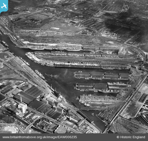
EAW006235 ENGLAND (1947). The Salford Docks and Manchester Ship Canal, Salford, 1947
© Copyright OpenStreetMap contributors and licensed by the OpenStreetMap Foundation. 2026. Cartography is licensed as CC BY-SA.
Nearby Images (15)
EAW006235

EPW019157

EAW050416

EPW028014

EAW021935

EAW006236

EPW027860

EPW027781

EAW000804

EPW041685

EPW027857

EPW028015

EPW017596

EPW027729

EAW050417

Details
| Title | [EAW006235] The Salford Docks and Manchester Ship Canal, Salford, 1947 |
| Reference | EAW006235 |
| Date | 25-May-1947 |
| Link | |
| Place name | SALFORD |
| Parish | |
| District | |
| Country | ENGLAND |
| Easting / Northing | 380821, 397119 |
| Longitude / Latitude | -2.2889599134275, 53.47020391373 |
| National Grid Reference | SJ808971 |
Pins

redmist |
Thursday 26th of January 2023 07:27:47 PM |