
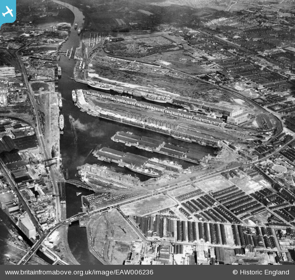
EAW006236 ENGLAND (1947). The Salford Docks and Manchester Ship Canal, Salford, 1947
© Copyright OpenStreetMap contributors and licensed by the OpenStreetMap Foundation. 2026. Cartography is licensed as CC BY-SA.
Nearby Images (10)
EAW006236

EAW050416

EAW021935

EPW019157

EAW006235

EPW041685

EPW028014

EPW055071

EAW050417

EPW027781

Details
| Title | [EAW006236] The Salford Docks and Manchester Ship Canal, Salford, 1947 |
| Reference | EAW006236 |
| Date | 25-May-1947 |
| Link | |
| Place name | SALFORD |
| Parish | |
| District | |
| Country | ENGLAND |
| Easting / Northing | 380939, 397125 |
| Longitude / Latitude | -2.2871824581214, 53.470262135621 |
| National Grid Reference | SJ809971 |
Pins

I Sharratt |
Thursday 18th of April 2024 08:09:29 AM | |
|
I Sharratt |
Thursday 18th of April 2024 08:06:59 AM | |
|
I Sharratt |
Thursday 18th of April 2024 08:05:53 AM | |
|
Atellyer |
Wednesday 15th of February 2023 09:44:47 PM | |
|
redmist |
Thursday 26th of January 2023 07:32:37 PM | |
|
boltie |
Sunday 30th of March 2014 04:04:56 PM |