
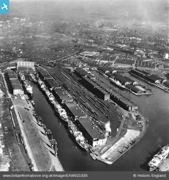
EAW021935 ENGLAND (1949). Manchester Docks, Salford, 1949. This image has been produced from a print.
© Copyright OpenStreetMap contributors and licensed by the OpenStreetMap Foundation. 2026. Cartography is licensed as CC BY-SA.
Nearby Images (15)
EAW021935

EAW050416

EPW019157

EAW006235

EAW006236

EPW041685

EPW027781

EPW028014

EAW000804

EPW027857

EPW027860

EAW021937

EPW028015

EAW021936

EPW055071

Details
| Title | [EAW021935] Manchester Docks, Salford, 1949. This image has been produced from a print. |
| Reference | EAW021935 |
| Date | 9-April-1949 |
| Link | |
| Place name | SALFORD |
| Parish | |
| District | |
| Country | ENGLAND |
| Easting / Northing | 380871, 397215 |
| Longitude / Latitude | -2.288212446527, 53.471068714501 |
| National Grid Reference | SJ809972 |
Pins
Be the first to add a comment to this image!