
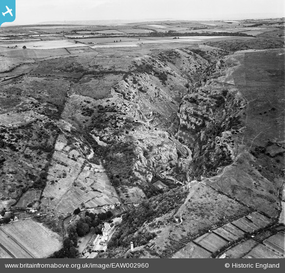
EAW002960 ENGLAND (1946). Cheddar Gorge, Cheddar, from the south-west, 1946
© Copyright OpenStreetMap contributors and licensed by the OpenStreetMap Foundation. 2025. Cartography is licensed as CC BY-SA.
Nearby Images (7)
EAW002960

EPW033354

EAW023183

EAW023182

EPW033352

EAW025161

EAW025158

Details
| Title | [EAW002960] Cheddar Gorge, Cheddar, from the south-west, 1946 |
| Reference | EAW002960 |
| Date | 2-October-1946 |
| Link | |
| Place name | CHEDDAR |
| Parish | CHEDDAR |
| District | |
| Country | ENGLAND |
| Easting / Northing | 346428, 153810 |
| Longitude / Latitude | -2.7681821620817, 51.280401392196 |
| National Grid Reference | ST464538 |
Pins
Be the first to add a comment to this image!