
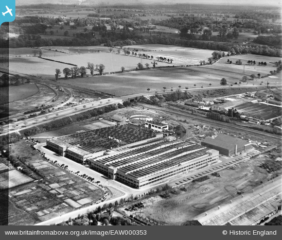
EAW000353 ENGLAND (1946). The Odhams Press Printing Works and the surrounding countryside, Watford, 1946. This image has been produced from a damaged negative.
© Copyright OpenStreetMap contributors and licensed by the OpenStreetMap Foundation. 2026. Cartography is licensed as CC BY-SA.
Nearby Images (8)
EAW000353

EAW000349

EAW000351

EAW000350

EAW000354

EPW060225

EAW000352

EAW000355

Details
| Title | [EAW000353] The Odhams Press Printing Works and the surrounding countryside, Watford, 1946. This image has been produced from a damaged negative. |
| Reference | EAW000353 |
| Date | 1-April-1946 |
| Link | |
| Place name | WATFORD |
| Parish | |
| District | |
| Country | ENGLAND |
| Easting / Northing | 511582, 199138 |
| Longitude / Latitude | -0.385935414602, 51.679445242491 |
| National Grid Reference | TQ116991 |
Pins

Sparky |
Friday 1st of September 2017 04:36:10 PM |
User Comment Contributions
Surely, this is Odhams Press NOT Oldhams. |

knightley |
Wednesday 6th of November 2013 02:39:25 PM |