
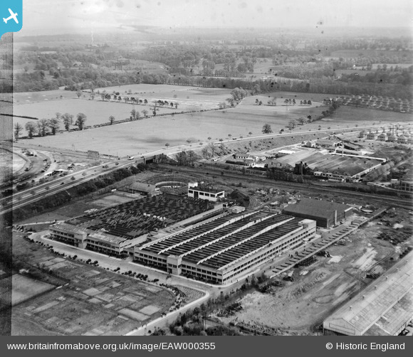
EAW000355 ENGLAND (1946). The Odhams Press Printing Works and the surrounding countryside, Watford, from the west, 1946. This image has been produced from a damaged negative.
© Copyright OpenStreetMap contributors and licensed by the OpenStreetMap Foundation. 2026. Cartography is licensed as CC BY-SA.
Nearby Images (7)
EAW000355

EAW000352

EAW000351

EAW000354

EAW000349

EAW000350

EAW000353

Details
| Title | [EAW000355] The Odhams Press Printing Works and the surrounding countryside, Watford, from the west, 1946. This image has been produced from a damaged negative. |
| Reference | EAW000355 |
| Date | 1-April-1946 |
| Link | |
| Place name | WATFORD |
| Parish | |
| District | |
| Country | ENGLAND |
| Easting / Northing | 511369, 199061 |
| Longitude / Latitude | -0.3890397707876, 51.67879540057 |
| National Grid Reference | TQ114991 |
