
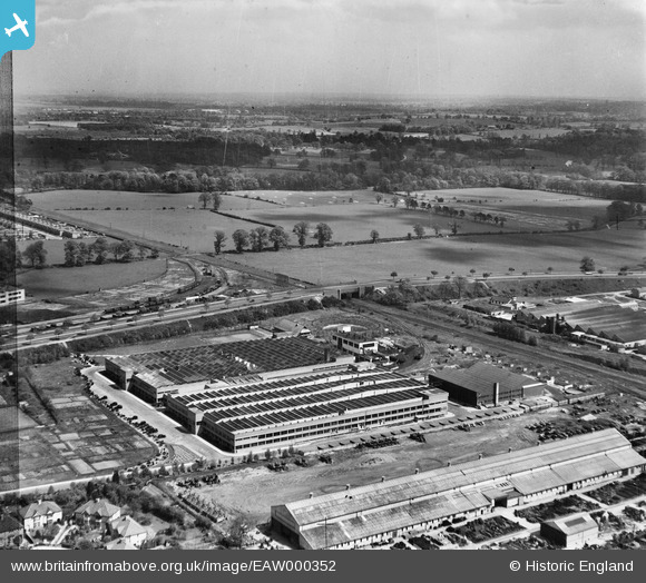
EAW000352 ENGLAND (1946). The Odhams Press Printing Works and the surrounding countryside, Watford, from the south-west, 1946. This image has been produced from a damaged negative.
© Copyright OpenStreetMap contributors and licensed by the OpenStreetMap Foundation. 2026. Cartography is licensed as CC BY-SA.
Nearby Images (7)
EAW000352

EAW000355

EAW000351

EAW000354

EAW000349

EAW000353

EAW000350

Details
| Title | [EAW000352] The Odhams Press Printing Works and the surrounding countryside, Watford, from the south-west, 1946. This image has been produced from a damaged negative. |
| Reference | EAW000352 |
| Date | 1-April-1946 |
| Link | |
| Place name | WATFORD |
| Parish | |
| District | |
| Country | ENGLAND |
| Easting / Northing | 511380, 199042 |
| Longitude / Latitude | -0.38888678495409, 51.678622434004 |
| National Grid Reference | TQ114990 |

