
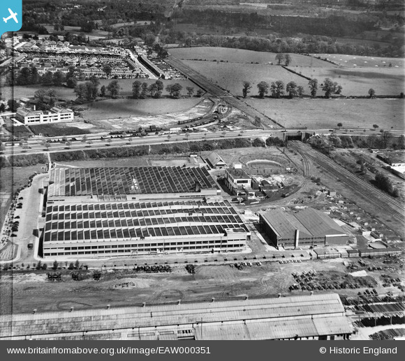
EAW000351 ENGLAND (1946). The Odhams Press Printing Works and the surrounding area, Watford, 1946. This image has been produced from a damaged negative.
© Copyright OpenStreetMap contributors and licensed by the OpenStreetMap Foundation. 2026. Cartography is licensed as CC BY-SA.
Nearby Images (7)
EAW000351

EAW000349

EAW000353

EAW000354

EAW000350

EAW000355

EAW000352

Details
| Title | [EAW000351] The Odhams Press Printing Works and the surrounding area, Watford, 1946. This image has been produced from a damaged negative. |
| Reference | EAW000351 |
| Date | 1-April-1946 |
| Link | |
| Place name | WATFORD |
| Parish | |
| District | |
| Country | ENGLAND |
| Easting / Northing | 511489, 199124 |
| Longitude / Latitude | -0.38728458227523, 51.679337873994 |
| National Grid Reference | TQ115991 |
Pins

Matt Aldred edob.mattaldred.com |
Tuesday 7th of July 2026 05:23:52 PM | |

The Laird |
Thursday 6th of June 2019 01:06:59 PM |