
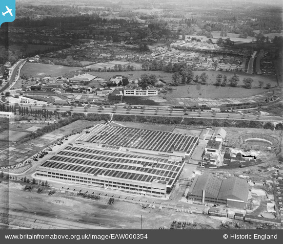
EAW000354 ENGLAND (1946). The Odhams Press Printing Works and the surrounding area, Watford, 1946. This image has been produced from a damaged negative.
© Copyright OpenStreetMap contributors and licensed by the OpenStreetMap Foundation. 2026. Cartography is licensed as CC BY-SA.
Nearby Images (7)
EAW000354

EAW000350

EAW000351

EAW000349

EAW000353

EAW000355

EAW000352

Details
| Title | [EAW000354] The Odhams Press Printing Works and the surrounding area, Watford, 1946. This image has been produced from a damaged negative. |
| Reference | EAW000354 |
| Date | 1-April-1946 |
| Link | |
| Place name | WATFORD |
| Parish | |
| District | |
| Country | ENGLAND |
| Easting / Northing | 511451, 199227 |
| Longitude / Latitude | -0.38780114076426, 51.680271250368 |
| National Grid Reference | TQ115992 |
Pins

The Laird |
Thursday 6th of June 2019 01:08:06 PM |
User Comment Contributions
he crrect name of the printing company was Odhams (no "L") |
Bob Hawkins |
Wednesday 11th of September 2013 10:17:05 AM |
Whoops! Thanks for pointing this out - I'll make sure the extra 'L' is deleted. Best wishes Laura Maddison (Britain from Above Cataloguer) |

Laura Maddison |
Wednesday 11th of September 2013 10:17:05 AM |