Skip to main content
Prydain oddi Fry
Cymraeg
|
English
Mewngofnod
|
Cofrestru
Toggle navigation
Hafan
Gwaddol
Ynghylch
Map
Orielau
Grwpiau
Cymorth
Chwilio
Pob Gwlad (96344)
Lloegr (82521)
Yr Alban (6398)
Cymru (4321)
Gweddill y Byd (3104)
Gwlad Belg (7)
Ffrainc (27)
yr Almaen (2)
Guernsey (116)
Iran (8)
Irac (6)
Iwerddon (1466)
Ynys Manaw (75)
Jersey (122)
yr Iseldiroedd (20)
Northern Ireland (1163)
Sbaen (9)
y Swisdir (26)
Gweithgaredd Diweddaraf
Saved Images
Pagination
First page
first
Previous page
previous
…
Tudalen
15
Tudalen
16
Tudalen
17
Tudalen
18
Current page
19
Tudalen
20
Tudalen
21
Tudalen
22
Tudalen
23
…
Next page
next
Last page
last
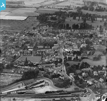
[EPW022726] The town, Farnham, from the south-east, 1928
[WPW048358] View of Onllwyn coal washery, processing and distribution centre, commissioned by Evans & Bevan, Neath. Oblique aerial photograph, 5"x4" BW glass plate.
[EPW024606] The Cliff Brick Works, Cliff, 1928
[EAW028721] The SS Himalaya at the Landing Stage of Tilbury Docks, Tilbury, 1950
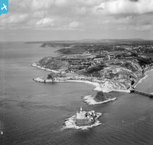
[WAW017157] View of Mumbles Head showing pier, lighthouse and fort. Oblique aerial photograph, 5½" cut roll film.
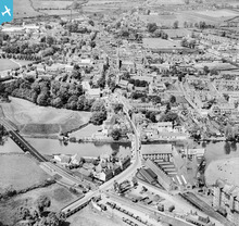
[EPW041329] The town, Huntingdon, from the south-east, 1933
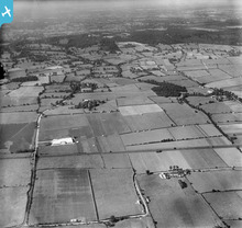
[EPW040435] Alma Food Products Ltd and surrounding countryside, Great Warley, from the south, 1932
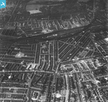
[EAW030136] Lavender Hill, Queenstown Road, West London Junction, Longhedge Junction and Battersea Park, Battersea, 1950. This image has been produced from a print.
Pagination
First page
first
Previous page
previous
…
Tudalen
15
Tudalen
16
Tudalen
17
Tudalen
18
Current page
19
Tudalen
20
Tudalen
21
Tudalen
22
Tudalen
23
…
Next page
next
Last page
last
This user has had no activity in the last year.