Skip to main content
Prydain oddi Fry
Cymraeg
|
English
Mewngofnod
|
Cofrestru
Toggle navigation
Hafan
Gwaddol
Ynghylch
Map
Orielau
Grwpiau
Cymorth
Chwilio
Pob Gwlad (96344)
Lloegr (82521)
Yr Alban (6398)
Cymru (4321)
Gweddill y Byd (3104)
Gwlad Belg (7)
Ffrainc (27)
yr Almaen (2)
Guernsey (116)
Iran (8)
Irac (6)
Iwerddon (1466)
Ynys Manaw (75)
Jersey (122)
yr Iseldiroedd (20)
Northern Ireland (1163)
Sbaen (9)
y Swisdir (26)
Gweithgaredd Diweddaraf
Saved Images
Pagination
First page
first
Previous page
previous
Tudalen
1
Tudalen
2
Current page
3
Tudalen
4
Tudalen
5
Tudalen
6
Tudalen
7
Tudalen
8
Next page
next
Last page
last
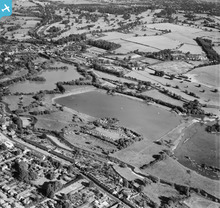
[EPW039623] Batchworth Lake and environs, Batchworth, from the east, 1932
[EAW026494] Bury Lake and environs, Rickmansworth, 1949
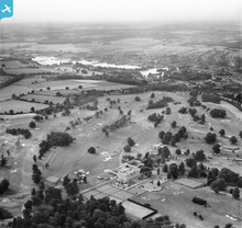
[EAW046076] Moor Park Club House and Golf Course, Moor Park, from the south-east, 1952
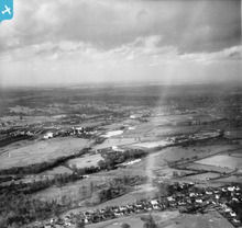
[EAW004066] The Colne Valley, Moor Park, 1947
[EPW031287] Tolpits Lane, Moor Farm and environs, Moor Park, 1930. This image has been produced from a damaged negative.
[EPW031467] Sandy Lodge Lane, Sandy Lodge Golf Course and Common Moor, Moor Park, from the south-east, 1930
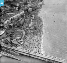
[EPW039325] The Royal Victoria Pavilion and 'Pleasurama', Ramsgate, 1932
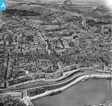
[EPW035452] The Royal Parade and the town centre, Ramsgate, 1931
Pagination
First page
first
Previous page
previous
Tudalen
1
Tudalen
2
Current page
3
Tudalen
4
Tudalen
5
Tudalen
6
Tudalen
7
Tudalen
8
Next page
next
Last page
last
This user has had no activity in the last year.