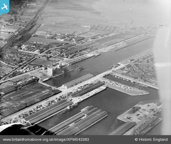
XPW043383 NORTHERN IRELAND (1933). Belfast Harbour Commissioners, Belfast, Belfast, Northern Ireland, 1933. Oblique aerial photograph taken facing North.
© Hawlfraint cyfranwyr OpenStreetMap a thrwyddedwyd gan yr OpenStreetMap Foundation. 2026. Trwyddedir y gartograffeg fel CC BY-SA.
Manylion
| Pennawd | [XPW043383] Belfast Harbour Commissioners, Belfast, Belfast, Northern Ireland, 1933. Oblique aerial photograph taken facing North. |
| Cyfeirnod | XPW043383 |
| Dyddiad | 1933 |
| Dolen | |
| Enw lle | BELFAST |
| Plwyf | NORTHERN IRELAND |
| Ardal | |
| Gwlad | NORTHERN IRELAND |
| Dwyreiniad / Gogleddiad | 147380, 531318 |
| Hydred / Lledred | -5.914014, 54.613644 |
| Cyfeirnod Grid Cenedlaethol |
Pinnau
Byddwch y cyntaf i ychwanegu sylw at y ddelwedd hon!


![[XPW043383] Belfast Harbour Commissioners, Belfast, Belfast, Northern Ireland, 1933. Oblique aerial photograph taken facing North.](http://britainfromabove.org.uk/sites/all/libraries/aerofilms-images/public/100x100/XPW/043/XPW043383.jpg)
![[SPW051066] Maidens, general view, showing Maidens Harbour and Ardlochan Road. A large military shed, partially unroofed showing belfast roof trusses. A tram track leads from the building to the slip suggesting storage of equipment used at sea, possibly f](http://britainfromabove.org.uk/sites/all/libraries/aerofilms-images/public/100x100/SPW/051/SPW051066.jpg)
![[XPW043380] Belfast Harbour Commissioners, Belfast, Belfast, Northern Ireland, 1933. Oblique aerial photograph taken facing North.](http://britainfromabove.org.uk/sites/all/libraries/aerofilms-images/public/100x100/XPW/043/XPW043380.jpg)
![[XPW043381] Belfast Harbour Commissioners, Belfast, Belfast, Northern Ireland, 1933. Oblique aerial photograph taken facing North.](http://britainfromabove.org.uk/sites/all/libraries/aerofilms-images/public/100x100/XPW/043/XPW043381.jpg)