
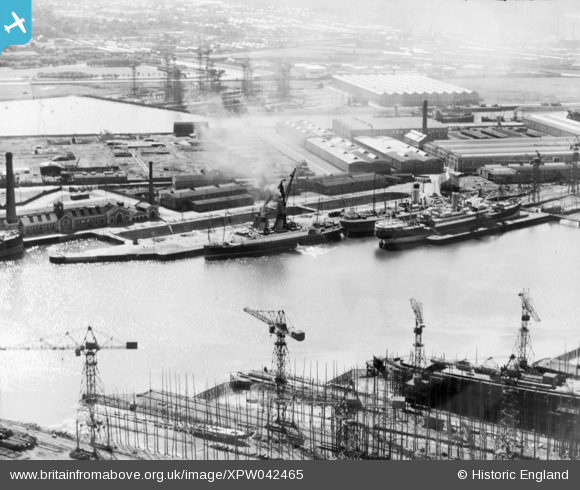
XPW042465 NORTHERN IRELAND (1933). Docks, Belfast, Belfast, Northern Ireland, 1933. Oblique aerial photograph taken facing South.
© Hawlfraint cyfranwyr OpenStreetMap a thrwyddedwyd gan yr OpenStreetMap Foundation. 2026. Trwyddedir y gartograffeg fel CC BY-SA.
Delweddau cyfagos (2)
XPW042465

XPW043375

Manylion
| Pennawd | [XPW042465] Docks, Belfast, Belfast, Northern Ireland, 1933. Oblique aerial photograph taken facing South. |
| Cyfeirnod | XPW042465 |
| Dyddiad | 1933 |
| Dolen | |
| Enw lle | BELFAST |
| Plwyf | NORTHERN IRELAND |
| Ardal | |
| Gwlad | NORTHERN IRELAND |
| Dwyreiniad / Gogleddiad | 148226, 531740 |
| Hydred / Lledred | -5.901308, 54.617854 |
| Cyfeirnod Grid Cenedlaethol |
Pinnau
Byddwch y cyntaf i ychwanegu sylw at y ddelwedd hon!