
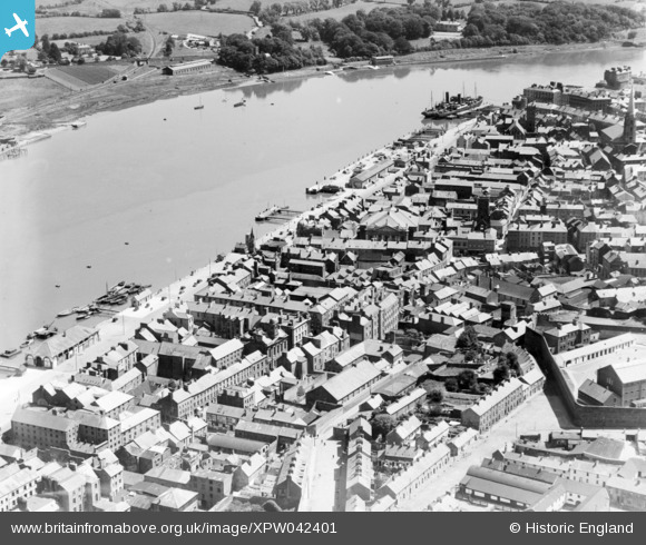
XPW042401 IRELAND (1933). General View, Waterford, Kilkenny, Ireland, 1933. Oblique aerial photograph taken facing East.
© Hawlfraint cyfranwyr OpenStreetMap a thrwyddedwyd gan yr OpenStreetMap Foundation. 2026. Trwyddedir y gartograffeg fel CC BY-SA.
Delweddau cyfagos (4)
XPW042401

XAW018980

XPW043432

XPW043433

Manylion
| Pennawd | [XPW042401] General View, Waterford, Kilkenny, Ireland, 1933. Oblique aerial photograph taken facing East. |
| Cyfeirnod | XPW042401 |
| Dyddiad | 1933 |
| Dolen | |
| Enw lle | WATERFORD |
| Plwyf | IRELAND |
| Ardal | |
| Gwlad | IRELAND |
| Dwyreiniad / Gogleddiad | 51049, 274941 |
| Hydred / Lledred | -7.115823, 52.261602 |
| Cyfeirnod Grid Cenedlaethol |
Pinnau

ofarrl1960 |
Saturday 11th of November 2017 07:10:38 PM | |
|
ofarrl1960 |
Saturday 11th of November 2017 07:08:43 PM | |
|
ofarrl1960 |
Saturday 11th of November 2017 07:07:39 PM | |
|
ofarrl1960 |
Saturday 11th of November 2017 07:06:00 PM |