
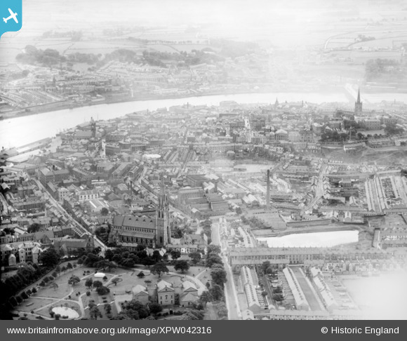
XPW042316 NORTHERN IRELAND (1933). General View, Londonderry, Derry, Northern Ireland, 1933. Oblique aerial photograph taken facing South/West.
© Hawlfraint cyfranwyr OpenStreetMap a thrwyddedwyd gan yr OpenStreetMap Foundation. 2026. Trwyddedir y gartograffeg fel CC BY-SA.
Delweddau cyfagos (4)
XPW042316

XPW042314

XPW042315

XPW042318

Manylion
| Pennawd | [XPW042316] General View, Londonderry, Derry, Northern Ireland, 1933. Oblique aerial photograph taken facing South/West. |
| Cyfeirnod | XPW042316 |
| Dyddiad | 1933 |
| Dolen | |
| Enw lle | LONDONDERRY |
| Plwyf | NORTHERN IRELAND |
| Ardal | |
| Gwlad | NORTHERN IRELAND |
| Dwyreiniad / Gogleddiad | 59446, 579990 |
| Hydred / Lledred | -7.327442, 54.997592 |
| Cyfeirnod Grid Cenedlaethol |
Pinnau
Byddwch y cyntaf i ychwanegu sylw at y ddelwedd hon!